 Up before the sun appeared this morning and immediately took to the laptop to write. Slumber last night was beautiful with no annoyances other than the odd mozzie. Our room had a floor of quartz and silcrete pebbles, our roof was the stars and the walls were low mulga and witchetty bush. As I lay this morning in the stillness of the piccaninny dawn I thought about those confined to the stale quarters of cities and those who have never slept under the stars. I thought about my companion of forty years breathing lightly beside me and I also thought about the places we have shared in those forty years. There were more things too; a mopoke calling to a mate, the smell of the gidgee and a whiff of smoke from last night’s mulga wood fire. What a way to start the day.
With regret we left the Mulga Gidgee Camp. We would like to have stayed longer but it would probably have been too hot during the day and we have to keep making tracks as we still have a long way to go.
Robert Louis Stevenson, one of the classic writers, wrote in 1879 a narrative he called ‘Travels With a Donkey’. The narrative focuses mainly on the humorous antics of his stubborn travel companion, Modestine a donkey he bought to carry his goods and shackles during a hiking trip in the Cevennes in South-Central France. One night he camped on a pine knob overlooking a misty sleeping valley and because he was so impressed with the camp the next morning he left some coins as a way of saying thankyou, hoping some ‘churlish drover’ didn’t find them. This morning I left coins for the same reason. I placed the coins on a rock in a prominent spot so if we return one day and find them gone we will know if someone else has shared the spot. If someone does find them I hope it’s a child and they quiz their parents incessantly as to why the two coins were there.

Coin temptation.
During this odyssey we hope to visit the Cevennes and maybe find the knob of pines Stevenson described. These days you can hire a donkey and follow the Robert Louis Stevenson trail. The trick is to hire a donkey from the top end of the trail and commence the walk from the southern end because as you walk north the donkey knows it is heading home. This means a more co-operative donkey.

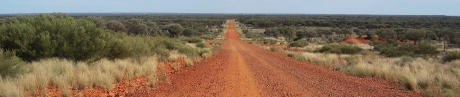
The Toompine, Windorah, Quilpie intersection
Windorah is located in the heart of the Channel Country, beside Cooper’s Creek. Its history is linked to the Whitman brothers who established the town. Originally known as Stony Point, its current name is the Aboriginal word for ‘place of large fish’. This relates to Cooper’s Creek, which is formed by the coming together of the Thomson and Barcoo Rivers to the north of where we are camped tonight.
Quilpie is reportedly an Aboriginal word meaning curlew, although its more correct pronunciation is probably ‘Queechee’. The people of Quilpie we met in the street today were friendly and eager to have a yarn but somehow I detected a malaise, which people of many outback towns seem to have these days. My thoughts are borne out by the fact that a struggling community in a NSW town offered city folk very cheap house rental to attract new residents to the town and some shires are selling building blocks for $1 in an attempt to attract new settlers to their area. One tourist information officer I spoke with said one of the reasons some towns are slipping into decline is that people are not travelling like they used to and fewer visitors reflects on the general economy of the towns. There are a number of reasons why people are not travelling to the outback as they did in the late 1990s including the cost of fuel, the high Australian dollar (people are finding it cheaper to holiday overseas) and maybe the baby boomers are getting too old to hit the road.
There are a number of attractions in Quilpie that are must visits for the traveller and they are the opal shops, the tourist information, art gallery and St Finbarrs church to see the altar made from opal and potch.

The altar in St Finbarrs church

Detail of the opal in altar

Fire escape.
Next door to St Finbarrs Church is a unique fire escape attached to the church boarding school. The fire escape is a slippery dip, which not only is a very effective way of escape but I suppose it encouraged children to exit quickly.

Improvised property sign
There is a lot of mulga and open grassland between Quilpie and Cooper’s Creek and that is what attracted pioneer graziers such as the Tullys, Costelloes and the Duracks of ‘Kings in Grass Castles’ fame. Patrick Durack was the main player. He left Ireland for Australia in 1853 and ended up founding a cattle empire across great stretches of Australia’s north. On one of his expeditions to Cooper’s Creek country he had a horse named Whynot but it died in a creek just west of Quilpie so the creek took the name of the horse. Later when the land around the creek was settled the people who took up the land called their property Whynot. I’m telling you this just in case you travel the road from Quilpie to Cooper’s Creek, see the sign and wonder.
During our Backtrack coach touring days to Birdsville and beyond we saw the country to the west of Quilpie in deepest drought and in times of plenty but nothing compares to what we experienced today. Grasses on the plains were belly high on cattle and growing right up to the edge of the road. In places it was even sprouting out of the bitumen. Waterways along the way were overflowing. Not having seen the area like this in the years we travelled through, it certainly had a WOW factor!

Lignum Ck crossing. This is a Cooper’s Creek overflow. To see it in flood is a rare event.

On the crossing

Cooper flood plain
Cooper’s Creek was named by explorer Sturt. He named the watercourse after Sir Charles Cooper who was a prominent South Australian judge. The term creek may seem confusing when you consider the mass of water in the creek today but when Sturt came across it the water levels were way down so he decided to name it a creek rather than a river. The apostrophe in Cooper’s Creek has drifted in and out of fashion however the locals of late say they want the apostrophe back.

The robust Cooper’s Creek sign
In the past there was a very flash colourful sign to let you know you had arrived at Cooper’s Creek but souvenir hunters stole it so the shire came up with a devious solution, a grader tyre filled with concrete.
The nicking of prominent landmark signs is a problem these days. Some road authorities put the signs up high to deter souvenir hunters but since the arrival of cordless angle grinders it is easy to fell and detach the sign and make off with it.

Cooper’s Creek running a banker. The water is about 7 metres deep.
Before the bridge was built (1940s) the only way across the Cooper was via a rocky crossing nearby or if the creek was in flood via one of two small steel rowing boats, one on each bank of the creek. First you rowed yourself to the opposite bank and collected the second boat and then rowed back towing it to the bank you started from and left it there. Then you rowed yourself to the opposite bank. Get that?
If you intend walking across the bridge watch out for road trains. If one appears you have a serious decision to make, do you make a run for it and get off the bridge or do you stand on the edge and clutch a flimsy guidepost and breath in? Road trains take some stopping so it’s up to you to take evasive action. It is even more uncomfortable if a cow in the trailer urinates all over you as the truck passes!

River red gum near the stony crossing. Note the face!
This magnificent specimen of a River Red gum is close to our camp and the old stony crossing. River Red gums have the ominous nickname of “Widow Maker” as they have a habit of dropping large boughs without warning. There are number of theories as to why they drop their branches but I reckon it’s because the tree takes up more water on a hot day, which makes the branches heavy so they fall. Some years ago I stood by the tree in the photograph with an expert on tree taxonomy and he estimated that this specimen could be 600 years old.
The botanical name for the River Red gum is Eucalyptus camaldulensis. It was named in honour of the private botanic garden of Count Camaldoli in Naples (L’Hortus Camaldulensis di Napoli), where the first specimen was described.

Channel country in flood
Cooper’s Creek catchment takes up one quarter of the Lake Eyre Basin and storm rains falling at the most distant point in the basin (up around Longreach way) take from nine to ten months to get to Lake Eyre. I have often thought a kayak trip down Cooper’s Creek to Lake Eyre would be a real adventure, however I think I’m a bit old for it now. Maybe in the next life if there is one.
Tonight we are happily camped on the banks of Cooper’s Creek not far upstream from the bridge. Usually there are a lot of grey nomads camped here but because the water is so high there are fewer campsites and the fishing is not so good.
All journeys have unknown destinations of which the traveller is unaware.
