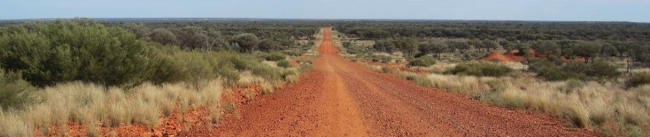
ROAD TRIP SWITZERLAND and RETURN via NORMANDY
PART 2 Ouyres to Coutances, Normandy.
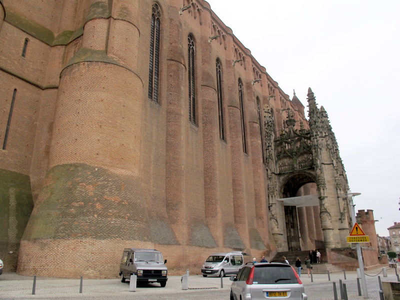
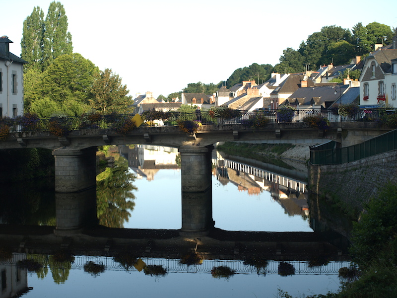
 ALBI
ALBI
After bidding friend Larry farewell at Ouyres we headed northwest through the Midi-Pyrenees area and the first town of note was Albi. The dominating feature of the town is the Cathedral of Saint Cecilia and it is where the Archbishop of Albi sits. We couldn’t get into the cathedral to see where he sat as a funeral service was under way.
The building of the cathedral commenced in 1287 and was not completed until two hundred years later. It is claimed to be the largest brick building in the world. Architecturally, it is classified as Southern French Gothic style.

The Cathedral of St Cecilia, Albi. Two hundred years in the making, hard to comprehend.
Cathedral of St Cecilia, Albi. It really is a big mass of building.
At first glance it looked like a brick church on the site had been destroyed and during rebuilding the Gothic portions were added. This was not the case. The cathedral was built in the style as it now stands. The hybrid style is definitely unusual and I’m not sure if it fits with my somewhat ordered mind.
The reason the cathedral is so fortress-like relates to the fact that just prior to it being built there had been an unsuccessful uprising by Cathers of the region against the Church of Rome. After the uprising the Catholic Church authorities decided to consolidate their position and it is thought that the building of a fortress-like church would demonstrate the power and strength of the church.
The crusade against the Cathers became known as the Albigensian Crusades and raged for twenty years from 1209-1229. An estimated one million people died during the crusade and many of those slaughtered lived in the city of Albi and its surrounds.
Elimination of individuals and communities of non-believers was typical of Rome’s thinking at the time. Cathers believed that many of the medieval society beliefs were odious. For example, they believed that Jesus was born of Joseph and Mary in the normal way and was adopted as God’s son at baptism. They proclaimed that the God worshipped by orthodox Christians was an imposter and his church was a corrupt abomination deeply infused by the evils of the material world. With beliefs like this it is easy to imagine those charged with protecting the Christian status quo were not impressed and therefore some sort of action needed to be taken.
During our Odyssey travels over the past couple of years I have read a lot of history and I find it difficult to believe just how many rebellions and wars there have been in Europe. There have been thousands and although not every one has been sparked by religious and ideological differences, most have. I have given thought on many occasions as to why men over the centuries have gone to war so readily. The answer is not because they were ideologically intelligent. It seems many went to war on promises of remission of sins and a guaranteed place in heaven. A crazy notion really, and until humanity abandons this sort of thinking the wars will continue.
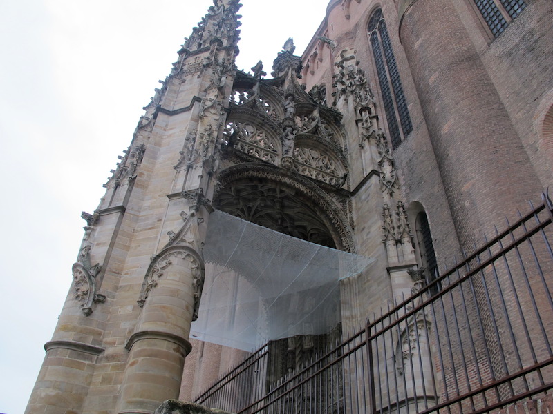
The entrance to the Albi cathedral. The screen is to either catch pigeon droppings or pieces of falling masonry.
Cathers believed in a form of reincarnation and if that belief extended to being reborn an animal I think that maybe the offending pigeons roosting in the roof of the church entranceway are reincarnated Cathers retaliating against the wrongs done to them in the 13th century.

A young Albigensian contemplating a dropoff from the cathedral wall.
Note the precise brickwork and the sloping abutments. Sloping abutments had a twofold purpose: firstly, they added strength to the wall and secondly, objects, such as large stones dropped from above, ricocheted off them at an angle and had a better chance of striking a raider.

Contemplation over and in the air. The adrenalin drop was a little under two metres…tough on axles, spokes and rims.

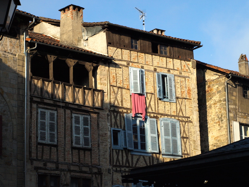
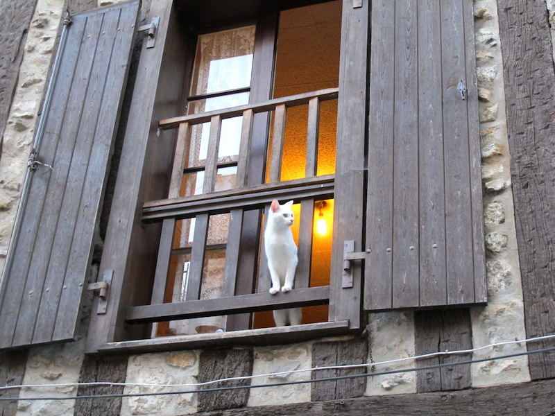
Half-timbered terracotta brick infill house in the medieval town of Albi.
Before mass transportation of materials houses were built with locally sourced materials and that is one of the reasons the buildings of rural France are so unique. The basalt, granite, slates, schists, mudstone, limestone and clay bricks give the buildings a distinct regional feel. Many buildings in Albi had a veranda on the top floor.

One of Albi’s narrow streets.
The episcopal city of Albi is a UNESCO World Heritage site: unfortunately we didn’t get to see it all. Maybe another time.

A poster in a shop window of Albi. Is she a reincarnated Albigensian thinking of wrongs committed in centuries past? Regardless, I love the artistry.
After Albi we continued further in a northwest direction stopping at villages that took our eye. Our stops revolved mostly around morning tea, lunch and afternoon tea and wherever we stopped we went exploring.
CORDES SUR CIEL
This was a small French town we came across by chance. The old part is situated on the top of a hill but we chose to wander in the streets below. Thomas ventured up and reported thousands of tourists taking in the sights. Bev and I, true to form when there are tourist masses about, took to the quiet back streets.
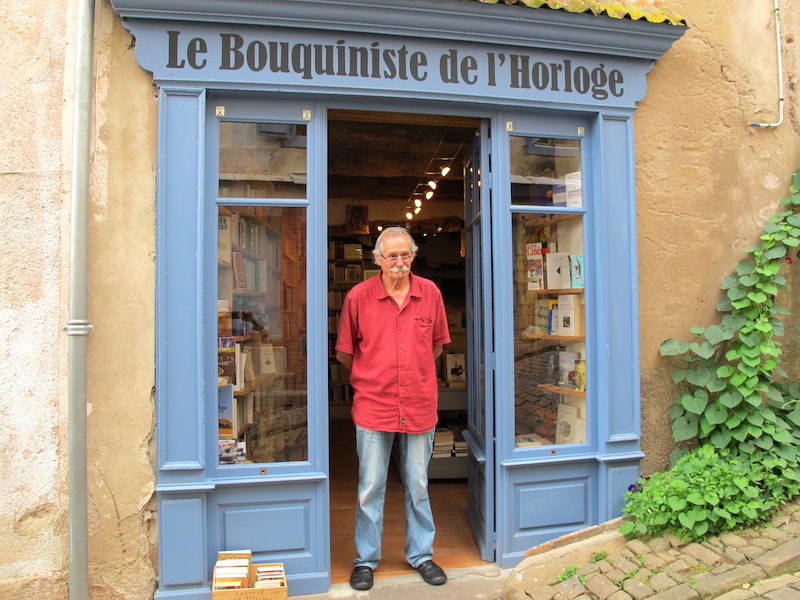
One of our finds, the Cordes Sur Ciel secondhand bookshop, with proud owner Pierre Crozet.
No matter where we roam it is impossible for us not to go into secondhand bookshops. On this occasion I’m glad we did because tucked away in a corner were a couple of early edition John Steinbeck books. My nephew, who I wrote about in the Prague post and who worked on the Orient Express in the 1990s, introduced me to Steinbeck and now I am on the lookout for his books wherever I go. The Cordes Sur Ciel bookshop yielded two more of Steinbeck’s books for my collection: Of Mice and Men and To a God Unknown.
John E. Steinbeck (1902-1968) was an American author of twenty-seven books including the award-winning novel, The Grapes of Wrath (1939). If you have never read this book, get into it, as it is a remarkable story set during the Great Depression about a poor tenant farming family driven from their home by drought and economic hardship.
FIGEAC.
Figeac is located on the Way of St James pilgrimage trail in the Midi-Pyrenees.
Half timbered houses in Figeac. Like in Albi, some had verandas on the top floor.
Verandas have a number of purposes and they include the shading of windows to keep the sun’s rays from striking the windows and heating the house, providing protection to the wood of window frames, a dry place under which to leave muddy outdoor wear and a place to relax protected from the elements.
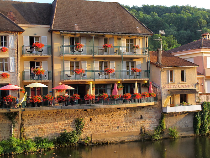
Hotel with verandas on the River Cele, Figeac.
ROCMADOUR
After an early morning walk around Figac we moved onto Rocmadour. Perched high on a rocky plateau Rocmadour overlooks the Alzou valley. It receives 1.5 million visitors a year and I think many of them must have been there when we arrived in the town.
It is a very holy place as there are many monastic buildings and pilgrimage churches overlooking the valley. Traditionally the town was dependent on pilgrims but now it’s the tourists who bring the trade. The day we were there it was jam-packed. I sat by the car and boiled the billy and waited for Bev while she photographed the cliff top part of the town from across the valley.
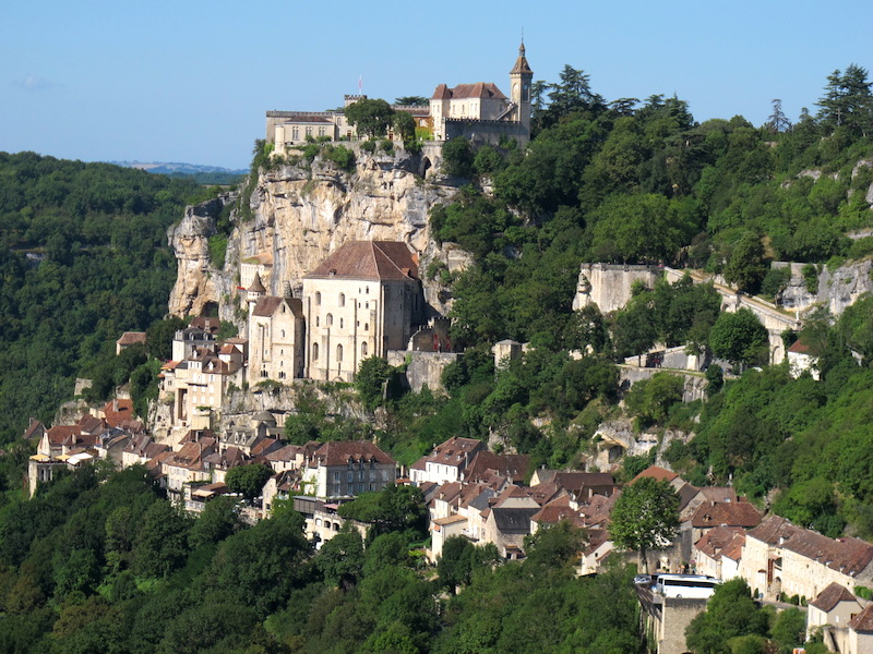
Monastic buildings of Rocamadour.
In the tourist blurb Bev read that in one of the churches there was a statue of a Black Madonna and knowing my want to find a black Madonna with African features asked if I wanted to go up there. But no, I couldn’t handle the crowds and instead we went poking around the back streets where tourists rarely venture. I found a shop where unbelievably for sale was 35mm colour film. The owner indicated to me that there wasn’t much call for roll film these days but he felt confident that people would return to film photography so he was going to keep the film in stock just in case.

35mm Kodak film waiting for a monastic miracle.
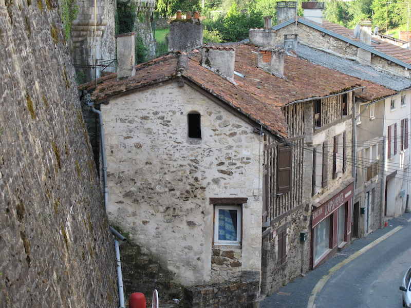
NONTRON
At the end of the day and in the process of looking for accommodation we came by chance across the town of Nontron. There is a place in Australia called Come-by-Chance which sits in the wide open black soil plains not far from where we live. Perhaps I will take you there one day in Encountering the Past Odyssey #3, into the Australian Outback.
There were no tourists in Nontron, they were all back at Rocmadour. As is often the case when you come across things by chance there are many interesting things to see. The domestic medieval architecture was the town’s main feature. The columbage (half-timbered) cottages were squashed together like books on a packed bookshelf. The cottages oozed historical tales, stories we will never realise.
A row of columbagian houses backed up against the town’s ramparts in Nontron.
Window detail of a columbagian house, Nontron.
Building a columbagian house is relatively easy, although hard work. The first step involves building a substantial timber frame; in this case the vertical columns (studs) were about 150mm square then the gaps between the timbers filled in. The in-fill material can be bricks, stones or mixed random rubble. The infill above was rock stuccoed with a cement render. The life of the building is relative to how long the timber columns last. If they were oak they could last many hundreds of years. What interested me with the Nontron houses was there were no cross-bracing timbers and I think the reason was that houses supported each other by the fact they were stacked close together like, as I said, books on a shelf.
Half-timbered house with timber cross bracing in the town of Josselin in Brittany.
In England when paint became freely available many homeowners painted the exposed timbers black and the infill white and hence the term ‘Magpie’ houses of England.
Nontron’s fountain, square, and town hall.

The French motto on the front of the town hall.
Liberte-Egalite-Fraternite
A man aspires to liberty, to equality, but he cannot achieve them without the assistance of other men through fraternity.
The motto had its origins during the French Revolution, however it was not accepted within official circles until the end of the 19th century. In times of the revolution the word Death was tacked onto the end of the motto indicating a fight to the death to defend liberte, egalite and fraternite.
Whilst digesting Liberte, Egalite and Fraternite the local airport taxi arrived and because I have minimalist attitudes even when it comes to cars I was more than interested in what I am now calling the Liberty Car. No central locking doors, electric windows, air conditioning to re-gas and all the other trappings of a modern car and almost complete freedom in car maintenance.

The Liberty Car (taxi) out the front of the town hall.

Discussing the qualities of the Liberty Car with its owner.
The liberty car is a Citroën Mehari. It has a plastic body and a 602cc engine. Citroën produce 144,953 units between 1968 and 1988. There is a 4wd version and was used by the French and Spanish army.
In the late 1940s my father owned a Morris 840 utility with an open back similar to the Liberty Car and I used to lie in the back as we travelled from my home in Belmore (suburb of Sydney) to Botany Bay to go fishing. I’m not sure if it was illegal to travel in the back of a ute. I think it may have been as I was under strict instructions not to stick my head up above the gunnel. Lying on my back meant my view was of only the sky and overhead power lines. As we motored through Sydney city streets I mapped in my mind power line and transformer configurations and thus knew exactly where I was at any point in time. The amusing thing about my father’s ute was that it had no doors: they were an optional extra. If I owned a Liberty Car I think for nostalgic reasons I would take the doors off. My father was so pedantically fussy about his car that when we went camping he took along a second tent in which he parked his car!
Another feature of Nontron is the beautiful masonry arch tunnels.
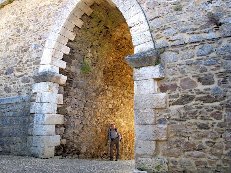
Standing with the stone. The builders of this beautiful arch must have been very proud of their efforts.

There is little to say except how beautiful this arch is. I use the word beautiful to mean ‘it is just right’.
When we were back in Greece I thought I would describe schematically how arches like the one in the above photographs were constructed. For reasons I cannot remember I never got around to it so I am going to do it now. But before getting on with the practicalities of arch building it is necessary to know the names for the various component parts of an arch.

1. KEYSTONE. 2. VOUSSOIR. 3. STRINGER. 4. IMPOST. 5. INTRADOS.
6. ABUTMENT. The arrows on the above sketch indicated the direction of forces.
The first step in building an arch is to put foundations in place (not shown in sketch) then erect on them the imposts (4) and the abutments (6) to stringers (3) height. The impost in the case of a bridge over a valley or river could be described as a pier. The next step is for wooden formwork to be erected as shown in the photograph below. Once the formwork is secured in position the stringer (3) and the voussoirs (2) are placed on top of the formwork. The last voussoir to go in place is the keystone (1). Once the stonework is complete the wooden formwork is removed.
Over the past thirty-five years we have built a number of pottery kilns using the method described above and there is a certain amount of awe when the formwork is removed and the arch stands free.
The above sketch is not technically perfect, however it was the best I could do with no drawing instruments other than a ruler and a pencil. The circular arch shape was drawn by tracing around the lid of a jam jar.

A stereoscopic card showing timber formwork in place and the voussoirs creeping to the apex of the arch. image from minneapolisparkhistory.com
Building a stone arch is a monumental effort but some credit must go to the carpenters and labourers who built, erected and removed the wooden formwork. That required a lot of skill and effort.
The above image is a stereoscopic card. The left portion is as the left eye would see the scene and the right portion is as the right eye would view the scene. When viewed in a stereoscope the two images combine in the brain giving the perception of 3D depth. Viewing 3D images in Victorian times was a very popular parlour activity.


Massive segmental arch of the Pont du Moulin des Pierres bridge near Montanges over the Valserine River in the Haute-Jura France. Image: Copyright free.
The Pont du Moulin bridge is part of the Bellegarde to Chezery electric tramway. It was built in 1910 but was destroyed in during WW2 hostilities and rebuilt in 1954.
On a number of occasions I have been asked via the comments section of this blog how much time I spend researching the blog. The answer is hundreds of hours but in the three years this blog has been active, researching the Pont du Moulin has taken the most time and the reason is I wanted to find an image of the wooden formwork used to support the voussoirs of the bridge. I was desperate to see the extent of the timber support frames. Fortunately I found a web page that showed their extent.
The page is headed: Le Chemin de Fer d’interet local de BELLEGARDE a CHEZERY. And its address is: http://etcomp.pagesperso-orange.fr/bellegarde/tramway.htm Go to it, it is an amazing story and don’t forget to hit the translation tab if you want to read the story in English.
There are a number of readers of this blog who are civil and structural engineers and I know when they see the original drawings and construction images they will, like I do, appreciate the engineering skills involved in building such a bridge. Following are a few images from the etcomp web site.

The incredible timber pylons and arch supports. What would the builders think if they knew their bridge was to be blown up by retreating Germans thirty-four years later?

How it’s done. Image from: Skyscrapercity.com

The concrete replacement, built in 1954. Image from: Skyscrapercity.com
Skyscrapercity.com is another excellent web page to go to if you want to wallow in bridges.
Very few masonry arch bridges were built after the 1920s as concrete construction required less labour so bridges were less expensive to build. The exception is China. Masonry bridges are still being built there and I guess its because there is plenty of labour available.
The following photograph is the last relating to arches. There is no doubt that building a masonry arch bridge takes a lot of skill, but how about the delicate arches in the following photograph?

Gothic ribbed vault arches in the Cathedral of Lucon,, a nondescript town but with this treasure.
In the above photograph there are two notable features other than the roof arches. One is a child’s coffin (on the left at the base of the column) and the other is the damaged columns themselves. When looking into the coffin I wondered whether the coffin was ever used and if so, how come it is here empty. The damaged columns also took my eye. I mulled over the circumstances relating to the damage. Not knowing these things is one of the fascinations of European history.
THAT’S THE END OF MY BRIDGE/ARCH RAMBLINGS, it’s time to get back on the road and move on towards the shores of the Bay of Biscay.

The chief ports around the Bay of Biscay are Brest, Saint-Nazaire, La Rochelle (the town we visited), and Bayonne in France and San Sebastián, Bilbao, and Santander in Spain. The bay has been the location for many naval battles over the centuries, mostly between the English, French, Portuguese and Spanish.
During WW2 (1943) the English engaged a group of German destroyers as part of Operation Stonewall. German U-boats ruled the bay at the time and as many as five thousand British and American ships were sunk during attempts to get supplies to France.
The Bay of Biscay is not a quiet tranquil bay. In fact, it’s just the opposite. It is where some of the most severe storms occur anywhere in the world. The reason relates to the fact that the European continental shelf extends into the bay and shallow waters mean big swells. The average depth of the bay is 1745 metres, which is considered shallow by world ocean standards. Shallow depths combined with gale force winds can beat up waves to well over twenty metres high and waves of that height can make it hard going for even the biggest of ships. The highest recorded wave height was thirty three metres. Recently, a container ship caught in a severe Bay of Biscay storm lost five hundred and twenty containers overboard. Most of the containers went to the bottom but those that didn’t created a major shipping hazard. Have you ever wondered why yachts sometimes disappear off the radar? It’s more than likely they struck a partly submerged shipping container.
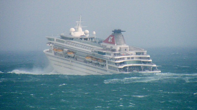
Cruise ship battling 17 metre high waves in the Bay of Biscay. Image from http://www.dailymail.co.uk
In Australia there is a particular type of country that was referred to in the days of early settlement as Bay of Biscay country. These days it is referred to as ‘gilgai’ country, which is made up of numerous small ephemeral lakes formed by the soil surface expanding and contracting in times of wet and dry. The surface of the country is up and down like the seas in the Bay of Biscay. Early immigrants from England had to cross the bay in small sailing vessels and when they arrived in Australia and took up gilgai country they referred to it as Bay of Biscay country. The route of immigrant ships is shown on the Bay of Biscay map.
The word gilgai is an aboriginal word for small waterhole. Other names in common use are melon or crab holes. The melon hole name relates to the fact that camel melons (introduced into Australia by Pakistani cameleers) grow in them and crab hole because they do look like beach crab holes.

Australian ‘Bay of Biscay’ country. Image credit: Mark Marathon via Wikipedia.
Sometimes the shallow depressions are actually touching each other making it very difficult to walk, ride or drive across. The sensation is very up and down.
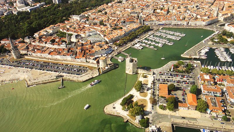
Old Harbour La Rochelle. The beach on the left is shown in the following image. Image credit:Mister Brown via Wikipedia.
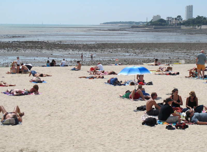
La Rochelle beach (on the European continental shelf) in the Bay of Biscay.
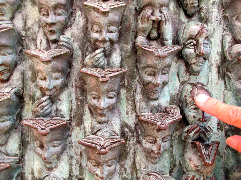
Faces of La Rochelle. The face above Bev’s finger looks Bay of Biscay seasick!
The above photograph is portion of a bronze wall plaque about two by one metres along an old sea wall.
This journey to Normandy is, we now believe, only an exploratory trip for a more serious journey at some time in the future. If we did return we would avoid at all costs the European school holiday period as it is difficult to appreciate what the various regions have to offer when there is bumper to bumper traffic and elbow to elbow people. One needs time and quietude to really appreciate the history and beauty of the French regions.
If Bev and I do visit France again we would buy a van, not a big camper van but a small three-door model. In the back I would place a few milk crates to put gear in, a mattress on top of the crates for sleeping and, of course, our foldup bikes. The van would need to be green in colour so we could stealth camp in forests. It is illegal to free camp in all European countries except Holland, Denmark and Sweden so hiding from authorities and those who are likely to dob one in is a must.
The French love vans and it is relatively easy and inexpensive to buy one in France.

Collector’s classic, the Citrone 1978 Fourgonnette (van). Photo source Wikipedia.
Even after their vans are no longer roadworthy the owners can’t bear to part with them. The following photographs show what I mean.

Some vans are recycled and are very green in Lucon.

Rear end of a Renault van in Lucon. Pity some fool opened the back door and let the garden soil out.

Renault Kangoo van, an ideal camper van.

Bridge across the Loire River near St Nazaire.
After crossing the Loire River we travelled through the scenic countryside of Brittany and came across the town of Josselin where we overnighted. Josselin is another of France’s medieval towns and home to a large castle. It is situated on the Nantes-Brest canal, one of many waterways that crisscross France.
The Nantes to Brest canal, Josselin.

Josselin Castle.
Unfortunately we had to keep moving so couldn’t dwell for too long. We reached the northwestern coast and revelled in the absence of crowds until……we reached one of the most prominent historical features of coastal France, Mont St Michel.

Salt flats and marshlands near Dinan on the way to Mont St Michel.
Mont St Michel draws an estimated three million visitors each year and I guessed that a good proportion of the three million were there today. Bev and I decided to opt out of walking to the island but instead find a quiet spot and just sit. Thomas joined the masses and walked out but it turned out he couldn’t get anywhere near the godly top as there were just too many people.

Mont St Michel surrounded by wheatfields, sea and history.
The spot Bev and I chose to sit was on the edge of a wheat stubble field. The dryness of the stubble brought to our mind thoughts of the vast wheat fields not far from where we live in Australia. Our time in the stubble was not ill spent. We reminisced about where we have been, things we have seen and done since leaving home six months ago and decided that of all our adventures since March the most rewarding achievement was our bike riding exploits in the Czech Republic, Poland and East Germany. Memories of that experience, although not epic like riding from Beijing to London through Siberia or the length of the Americas, will stay with us for many years to come. On this trip to France we miss our bikes and we are anxious to get back into the saddle.
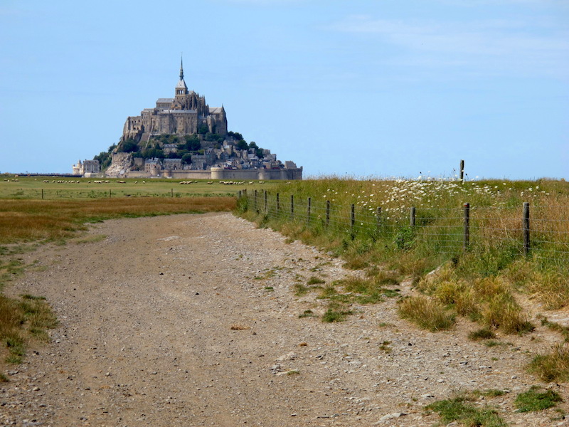
Another rural scene and Mont St Michel.

Mont St Michel stuck in a sea of mud. This photograph was taken before the levee-style causeway was replaced with a bridge. Image: Fabos via Wikipedia.
The levee-style causeway between the mainland and the island on which Mont St Michel was built changed the nature of the bay. It, along with other factors, caused severe siltation of the estuarine area. Realising the problem, authorities removed the causeway and built a bridge under which water flows freely and this, along with a new flushing hydraulic dam (scheduled for completion in 2015) on the Couesnon River, will ensure silts are washed out to sea. Whether this is good or bad depends on your point of view, I expect. If all goes to plan, Mont St Michel will once again become an island. From my observations I think the reason for silt buildup is probably because neighboring lands have been farmed and runoff from the farmed lands takes silts out into the bay. Similar situations have occurred all over the world. One specific case I know of is the discolouration and silting up of the Darling River in NSW not far from where we live. The Darling River these days carries colloidal clays and as a result is brown. An Aboriginal elder once told me that when he was a child the river was crystal clear and he and his mates dived deep and speared fish easily. It all changed when broadacre farming commenced and the run-off from the tilled lands took silts into the river. The same gentleman told me that his people do not like the land being farmed, as their belief is the earth is their mother and clearing and farming of their once traditional lands is akin to rape.
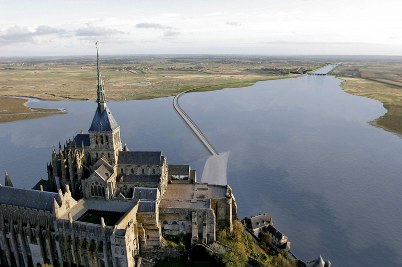
Looking over Mont St Michel and up the Couesnon River.
Mont Tombe was the name of the island where Mont St Michel was built. The first monastic establishment appeared in the 8th century and its evolution is, as one would expect, shrouded in religious myth. According to legend in the year 708 Archangel Michael appeared to St Aubert, a bishop in the region, and instructed him to build a church on the rocky island. Aubert refused to authorize the construction so St Michael burned a hole in the bishop’s forehead with his finger. This of course encouraged the bishop to get on with the job. Aubert’s skull is preserved in a local museum and it does have an indent in the forehead.
An archangel is no ordinary angel. They were, in the peck order of angels, on top and well above ordinary rank. I’m not sure if all archangels have skull-burning powers.
Mont St Michel was popularly nicknamed ‘St Michael in peril of the sea’ by medieval pilgrims making their way across the flats. If they didn’t judge the tides just right they drowned. The tides vary greatly at roughly fourteen metres between high and low tide. Whenever I read about pilgrims undertaking life-threatening pilgrimages I ask myself why they did it. The answer is that people desired to see and touch places and objects that were considered holy. They wanted to view places associated with Jesus or a favorite saint. Going on a dangerous pilgrimage was like doing penance, which was done in an attempt to gain forgiveness for sins committed. American author John Steinbeck, in his book ‘Travels With Charley’, asked if sins were simply accidents caused by forces beyond our control.
When reading and researching one often comes across a new word and the new one for me relating to this post is polderisation. I have a desktop folder labeled ‘Fred’s New Words’ in which I place new words I come across. It’s a way of keeping them close in case I want to use them one day. I collect words like some people collect stamps and coins. Polderisation is now in my collection, even though I will probably never have cause to use it again after this post.
A polder is a low-lying tract of land enclosed by embankments. Soils in enclosed lands usually have a high concentration of salts and naturally the plants growing on such soils taste salty. High salt, content plants are not necessarily useless, sheep are attracted to them because of the taste. The meat from sheep grazing on polderised land plants is rather tasty and it is much sought after by diners at boutique restaurants. Some restaurant owners promote the meat as ‘marinated on the hoof’, which in effect I suppose it is.
From Mont St Michel we headed up the west Normandy coast to Coutances with the aim of finding a hotel to stay the night. Eventually, after some difficulty we found a hotel, not in the town, but in an industrial estate on the outskirts.
Finding one’s way around the traffic-congested tourist areas of Normandy took some exceptional navigational skills. A friend of Thomas lent him a satellite navigation unit, which could amazingly guide us to our destination 95% of the time. However, the ‘girl in the box’ didn’t give us an overall view of where we were heading so Bev used good old-fashioned paper maps to add to the ‘girl in the box’ instructions. Personally, and in light of me being a mappist, I find taking instructions from some anonymous digitalised voice not to my liking. I prefer to use a map as there is a certain charm in consulting it then looking out and observing your surrounds. A map shows you what’s out there far beyond the horizon.
There is a belief that humans are beginning to see the world differently due to the use of computerised navigation and communications systems. I believe this may be true too as on trains, buses or at public transport venues the majority of the people these days are glued to their Smart phones. They appear not to notice other people around them or what is going on outside their concentrated sphere. I do believe that Smart phones are as addictive as nicotine and alcohol.
Again it’s the end of another post. The next post, Part 3 of our road trip from Switzerland to Normandy, takes us to the D-Day beaches and back to Switzerland via another quaint town discovery, Tonnerre, in the east of France. After returning to Switzerland we will mount our bikes once more and travel to Denmark and Sweden. Bev and I hope you will tag along.
A CLOSING NOTE: Of interest is that there are a couple of blog readers who are following in our footsteps. One asked if a dotted line on one of my maps was a walking track and whether it actually existed. This has got me to thinking that I had better make sure my maps are accurate in future. To date they have been what I call ‘mud maps’, just rough sketches. Please bear this in mind if you are following in our tracks.
‘Travel makes one modest. You see what a tiny place you occupy in the world’. Gustave Flaubert.
