PORTSMOUTH to SANTANDER SPAIN
TUESDAY 12th MAY 2015
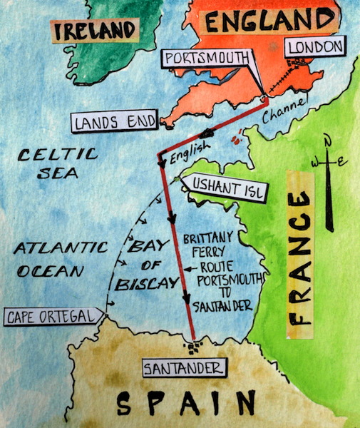
Map showing the route London, Portsmouth to Santander Spain.
When we first started planning this trip we intended to tour UK first and then make our way south through France, Spain, and Portugal to Morocco, however after studying the weather for Southern Europe I decided it would be far too hot down south in summer. Summertime temperatures in Morocco can reach 40-45 degrees centigrade. Also going south now means we will avoid the summer holiday crowds along the coast of Spain, Portugal and in Morocco. The quickest way south was to take a ferry and the most convenient was a Brittany ferry from Portsmouth to Santander on the north coast of Spain. First we had to get from Wanstead in the East End of London to Portsmouth and we decided going by train was the best option.
According to some, travelling on trains in England with bikes is not as straightforward as it is in Europe even though the official railway web pages say on most routes it’s not a problem. Some bike riders report having been harassed by both railway officials and the travelling public, and it was with this in mind I decided to read up on the British Rail policy. Simply put, ‘passengers with foldup bikes can travel anywhere any time’.

The sum total of our gear: four small paniers, two bikes, two small backpacks and a camera bag.

On the road at last. Note the homemade trolleys.
The trolley handpiece is made from hi-tech walking poles attached to skateboard wheels. During Encountering the Past Part 2 we had to carry the bikes at times which was difficult, especially when pushing along crowded railway platforms. The trolleys work 100% and I’m glad I went to the effort of making them for this trip.
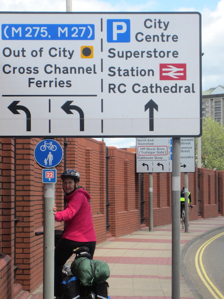
Getting from Wanstead to Portsmouth involved three separate train journeys, the first two on the underground and the third from Waterloo Station to Portsmouth Harbour. I mentioned in the previous post that in the early days of tube travelling passengers considered travelling on the tube was a form of torture. Regrettably, in my opinion, it is still true or at least it is on the Central Line. The torture is in the form of noise because the steel wheels of the train on steel rails screech when cornering and I reckon that people who travel the route on a daily basis will no doubt have hearing problems in the future. The two underground train journeys today were both sardine like, even though we travelled on the cusp of the peak hour period. A friendly Indian lady suggested that it would be more comfortable if we put our bikes against the left door as from then on only the right doors will open. She asked us where we were going and after explaining our proposed route she asked us could she come along as she has just taken redundancy after working for a bank for the last nineteen years. We meet many people envious of our travels and when we talk with them we realise how lucky we are.
Historic Waterloo Station was all go; over a quarter of a million passengers pass through Waterloo station each day. When seeking advice from a station attendant we were drawn into conversation and he wanted to know about our past and future travels. I gave him a card with our blog address and he said, “I will follow you, man’.
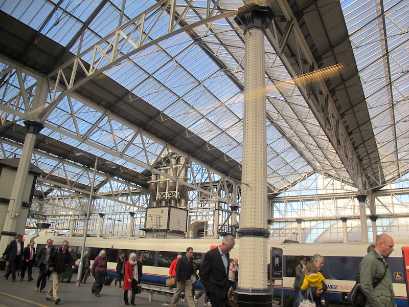
Arches of Waterloo Station. Why is it that all these commuters are looking down? Are they dreaming of exotic places beyond Waterloo?
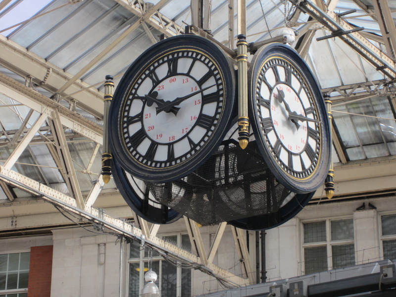
The Waterloo Station clock.
Under the clock is one of London’s most famous rendezvous points. The clock made in the 1920s has appeared in many films, TV series and novels.
The train from Waterloo to Portsmouth was a comfort, compared to the Underground. Again we struck up a conversation with the ticket collector, a gentle giant of a man whose interests were trains and motorbikes. He spotted our bikes and waxed lyrical about the fact we were on bikes. He told us he rode a motorbike, not a bicycle, and in the near future he was taking his new bride on a motorbike honeymoon.
First activity in Portsmouth was lunch. We were told about a top shop to buy fish and chips and we couldn’t resist the temptation. It’s funny but we can remember the top spots for fish and chips: Cardiff in Wales, Amsterdam and Constitution Dock in Hobart Tasmania, to name a few.

Admirals Portsmouth where one can engage in ‘Fish Madness’.

More than we could eat for $7-00.
Today’s visit to Portsmouth was not our first. We were here in the 1980s with our two boys. Who could not take an eight and a five year old to England and not have them see HMS Victory and the Mary Rose?
When we previously visited the Mary Rose museum the recovered part of the ship was lying on its side. It has since been righted and therefore easier to imagine its original form.

The Mary Rose as depicted in the Anthony Roll. The image has been identified as being free of known restrictions under copyright law.
The Anthony Roll is a record of ships of the English Tudor navy of the 1540s. It is named after its creator Anthony Anthony. It originally consisted of three rolls of vellum, depicting fifty-eight naval vessels. The rolls were presented to King Henry VIII in 1546. Good on you, Anthony. Without scribes such as yourself there would be few pictorial records of things prior to the advent of photography.
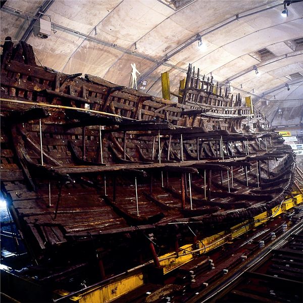
Portion of the HMS Mary Rose raised to the vertical and sitting on a steel cradle. Image courtesy of the Mary Rose Trust.
The name Mary Rose most probably came from King Henry VIII’s favourite sister Mary Tudor and the House of Tudor emblem, the rose. The ship was built between 1510 and 1512 and technically it is known as a carrack. Carracks were designed and first built by the Genoese and used as trading ships. The design usually incorporated three or four masts and their distinctive feature was the fore and aft ‘castles’. The Spanish and Portuguese used the carrack design of ships for their world exploration exploits.
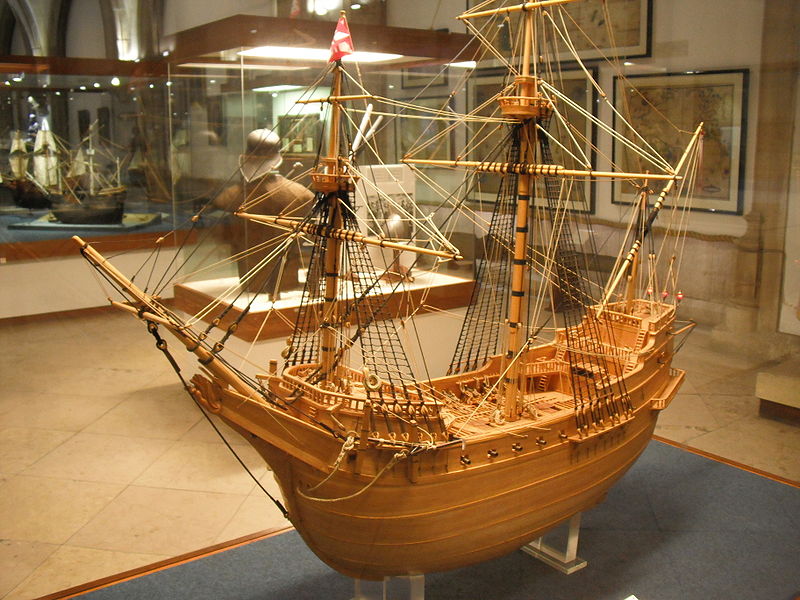
A model of the Madre de Deus carrack in the Lisbon Maritime Museum. Image in the public domain.
The Mary Rose was built from English oak and one estimate is that around six hundred mature oak trees were felled, totalling around sixteen hectares (about fifteen football fields) of trees. Bev and I visited Ireland in the 1980s and when there I wondered why much of the country was so barren. I was told that when shipbuilding was at its peak during Tudor times English woodchoppers came and felled most of Ireland’s useable timber and took it back to England for shipbuilding. I guess it made sense to destroy someone else’s backyard before your own.
During the glory time of the Mary Rose it was one of the largest ships in the English navy and with its mass of armaments it would have been a formidable foe. It was one of the earliest ships to have gun ports on the sides thus enabling it to fire a broadside. The firing of broadsides was a tricky operation as not only was the ship vulnerable to enemy fire but if the gun ports were left open and the ship listed whilst manoeuvring water could run in and flood the ship. Water entering through the gun ports may have been the reason the Mary Rose went to the bottom. Several written accounts of the sinking and an eyewitness recorded account suggests that all guns on one side had been fired and when turning to present the guns on the other side to the enemy she was caught by a strong gust of wind, she heeled and took on water through open gun ports.
At the time of its sinking a former high admiral claimed the ship had been lost because of ‘rechenes and great negligence’. A chronicle gave the reason for the loss as ‘to [o] much foly’..for she was laden with much ordinance, and the portes left open, which were low, and the ordinance unbreached, so that when the ship should turne, the water entered, and sodainly she sanke’.
The Mary Rose lay on the sea bed floor undisturbed for 437 years until two brothers discovered the wreck in 1836 and brought one of the ship’s cannons to the surface. The wreck was rediscovered in 1965 by a group of divers using sonar equipment and then with the help of various government bodies and volunteers the rotting remain was raised.
The raising of the Mary Rose was a milestone in the field of maritime archaeology, comparable in complexity and cost to the raising of the Swedish 17th century warship Vasa in 1961. The Vasa is more intact than the Mary Rose. If readers get the opportunity to see the Vasa as Bev and I did in 2006, don’t miss the chance. The Vasa is housed in Stockholm.
Raising old ships from the seafloor is a delicate operation. Undersea excavations have to be undertaken then, in the case of the Mary Rose, a steel cradle with airbag cushioning was placed around the hulk. The cradle and the remains of the ship weighed five hundred and fifty tonnes and it was lifted and placed on a barge and transported to shore.
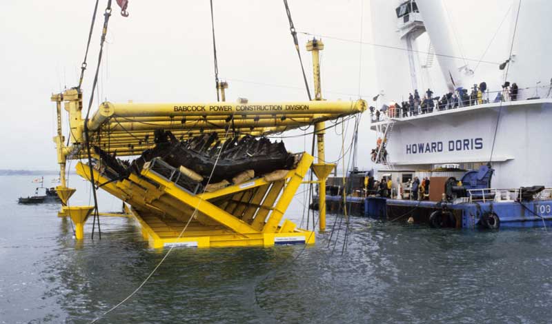
The delicate job of lifting the Mary Rose. Image from the Mary Rose Trust web page.
Once the hull was in a controlled atmosphere restoration began. Some timbers were replaced, the last piece went in in 1993. After being turned the conservation spray used to stop the hull drying out was replaced with a Polyethylene wax, which replaced the water in the timbers. By 2013 the hull was dry and it now sits in an environmentally controlled building. Many artefacts have been retrieved from around where the Mary Rose lay. The artefacts provide a window into the lives and doings of Tudor folk.
The other ship of Portsmouth fame is the Victory. It is much more physical than the Mary Rose as it is possible to go aboard which is pretty exciting knowing you are treading in the footsteps of Rear Admiral Lord 1st Viscount Horatio Nelson (1760-1802).

The man himself. Lord Nelson. Image credit: National Maritime Heritage Museum.
The hat depicted in the above photograph is not the one Nelson drew in the Lock and Co order book. It has no peak and the reason is probably due to artist licence. Had the painting included the peak it would have obscured Nelson’s face.
Whilst poking about the web in an attempt to find out why Nelson’s hat was the shape it was I came across an amazing web page historysheroes.e2bn.org. It details little known stuff about world heroes. There was no reference to why Nelson’s hat was the shape it was but there were other incredible facts such as: Nelson kept a coffin that was given to him as a gift close at hand at all times, he suffered from chronic sea sickness and the term, ‘to turn a blind eye’, was coined by Nelson. During the battle for Copenhagen he was given a signal by his commander to retreat but thinking the order unjustified he put his telescope to his blind eye and therefore could truthfully say, ‘I did not see the signal’.

HMS Victory. The flag on top of the mainmast is the St George Cross and the flag on the bow is the Royal Naval Ensign. Image credit: Copyright expired author unknown from Wikipedia
One thing that sticks in my mind when we last went aboard the Victory in the 1980s was the fact that some parts the ship’s decks were painted red. The reason was that blood from bleeding sailors was disguised and therefore the able bodied fought on and were not distracted by the blood around them.
During the battle of Trafalgar the Victory, under the command of Nelson, locked horns with the French ship Redoubtable. Both ships were blasting at each other at point blank range. High in the rigging of the Redoubtable was a French sharpshooter and he spotted Nelson standing on the deck of the Victory, he probably recognised Nelson’s by his hat. The sharpshooter took aim at his prized target and sent a musket ball into Nelson’s left shoulder. The ball continued into the admiral’s upper body smashing his lower back. The battle was all over for Nelson who was carried below deck and died soon after. He was buried in the coffin he kept close at hand.
HMS Victory was launched in 1765 and again the forests paid the price. It is estimated that six thousand trees were used of which 90% were oak. The Victory had thirty-seven sails which could propel the vessel at around twelve kilometres per hour, not what you would call a high speed vessel especially when attempting to escape oncoming cannon balls.

English oak, Quercus robur. Image credit: inhabit.com
The Victory has been in dry dock since 1922 and more than twenty two million people have walked her decks. The physical appearance of the Victory suggests to me it was much more functional compared to the Mary Rose. The Victory was built for action with its low profile, rounded gunnels and deck heads, a very stylish and functional vessel indeed.
There are few boys of my era who did not marvel at Britain’s naval power. I was obsessed with war ships; I made wooden models, something in retrospect I must have been good at as I sold them for a handsome profit to school friends.
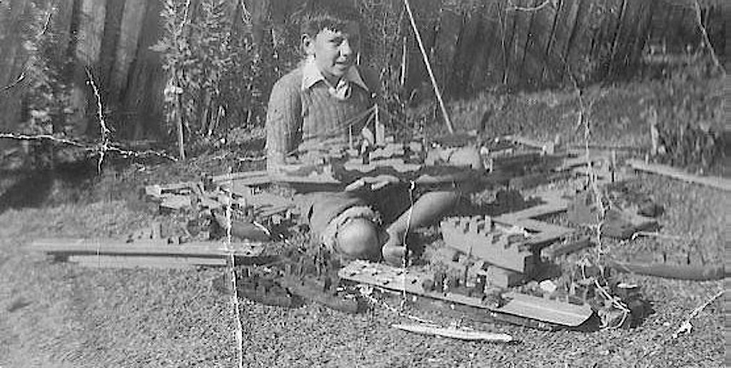
At the age of about eleven with my wooden creations, destroyers, cruisers, aircraft carriers and even a submarine (at the very front).
In more recent years I’m still making boats. The following images show a few of my ceramic creations. One year I made ceramic boats with indigenous kids of Torres Strait and in the process taught water safety to them under the auspices of the Australian Maritime Safety Authority.

A ceramic tinnie (aluminium runabout), in the birdbath on our property. The frog is real, it decided it wanted to go sailing.
In the above photograph it is possible to see an EPIRB (emergency beacon) on the stern seat, a spare jerry can of fuel, a paddle, anchor and life jacket, all prerequisites for safe boating.

A recent ceramic reproduction of a Greek fishing boat.
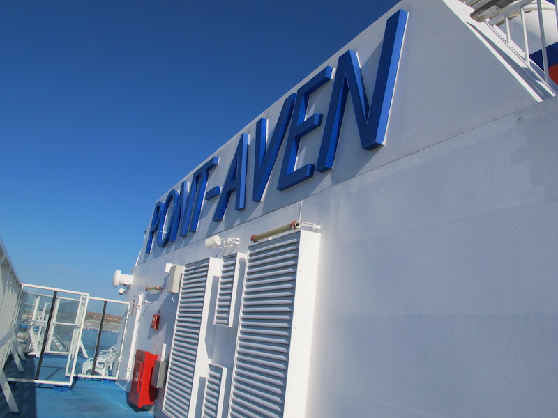
After our delicious fish and chips madness we continued on to the ferry terminal to board the Pont-Aven for our overnight sailing to Santander (pronounced San tan dair).

Getting orientated and plotting the route to the ferry terminal.

Heading into the bowels of the Brittany ferry Pont-Aven.
The Pont-Aven is a ferry/cruise ship. The company claims they were the first to run a hybrid cruise liner/ferry between France and England. Understandably due to my interest in ships and boats I thought the Pont-Aven was the ultimate. It was the biggest and most luxurious vessel I have ever been on.

Pont-Aven on the high seas.
The above photograph was taken pre 2004; I know because in 2006 the Pont-Aven ploughed into a fourteen metre high wave and the lower rectangular windows were severely damaged. The rectangular windows were replaced with round portholes.

The damaged windows were similar to the ones shown here.
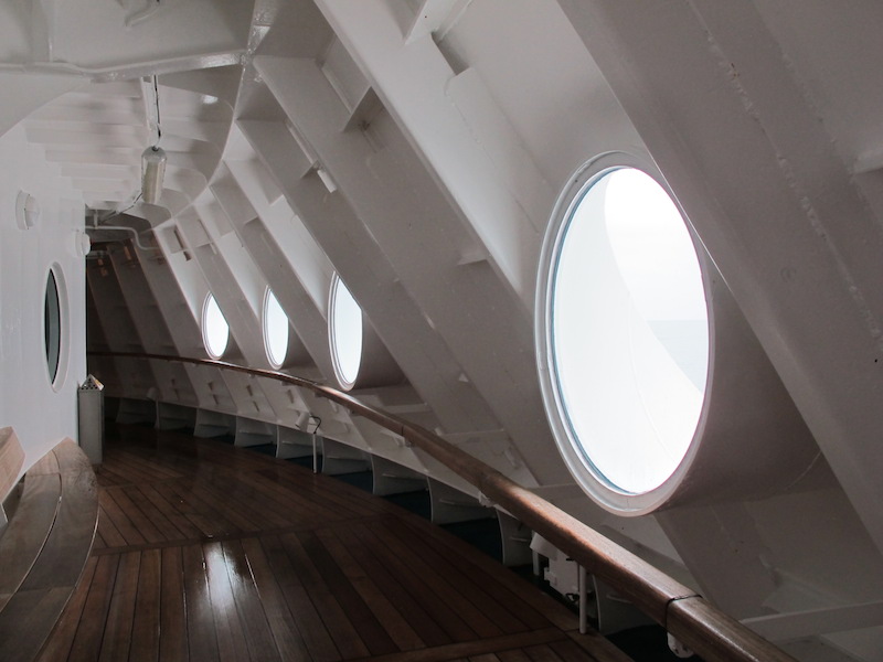
The circular replacements. The glass was about 20mm thick.
One English newspaper reported the incident thus: ‘British holidaymakers on board a packed car ferry heading for Spain screamed in terror as a 40ft freak wave crashed into the boat. The Pont Aven-flagship of the Brittany Ferries fleet-was battered by gale force nine winds when it entered the stormy Bay of Biscay. As the wall of water pounded the 40 000 tonne vessel, windows were smashed and cabins and decks 50ft above the water line were flooded’. The Brittany Ferry report: ‘There was no panic on the vessel….Most of the passengers were in the restaurant or bar at the time the wave hit, so there were only 10 or 20 people directly affected’.
The spick and span upper deck.
The Pont-Aven is named after a small town in Brittany. The town’s claim to fame is that impressionist painters Monet and Gauguin both worked in the area and as a result the interior of the Pont-Aven has been decorated accordingly, the ship even boasts a Gauguin painting although we couldn’t find it.
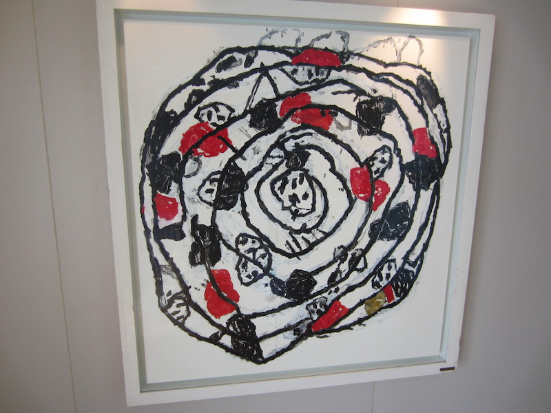
One of the many modern-style paintings on the walls of the Pont Aven.
Brittany Ferries began trading in January 1973, primarily to export vegetables from Western Brittany to the UK. Over the years the service developed into a major transport network linking ten ports in the UK, France, Spain and Ireland. The company boasts carrying nearly 2.5 million passengers, 800,000 cars and 195,000 trucks each year.
The Pont-Aven is Brittany Ferries’ flagship and was built by Meyer Werft Company in Papenburg, Germany. It was laid down in April 2003, launched in September 2003 (only five months) and completed in 2004 well ahead of schedule. The total cost was two hundred million dollars.
Following is a photograph of other vessels built by Meyer Werft. It is possible to tour the Meyer Werft shipyard, I think touring the shipyard might have to go onto my ‘Bucket List’.

A few of the many luxury liners Meyer Werft, of Papenburg, Germany have built. Image from Meyer Werft official web site.
The Pont-Aven is not in the above photograph as far as I can determine, however it is up there with the biggest. It is 184.60 metres long, which means at walking pace it would take about three minutes to walk from the bow to the stern; It has a beam (width) of 30.90 metres; weighs 41 700 gross tonnes, that’s equivalent to the combined weight of about 70 000 Mini minor cars; a draught (depth below the waterline) of 6.8 metres; and a service speed of 27 knots (50kph).
To keep this huge vessel functioning and to care for its 2 400 passengers, their cars, caravans, campervans, motorbikes, dogs (there are special compartments for dogs) and of course our two bicycles the crew complement adds up to 183.
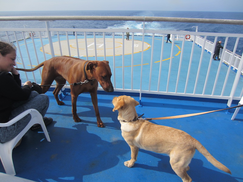
Dog meets dog on the dog deck. The helicopter pad can be seen in the background.

Dog, cat and ferret quarters. Hard to believe people actually take their pet ferrets on holidays with them!
The ship has four Cat 4 stroke oil burning engines. The combined power produced is 50 400 kW (approximately 76 500HP), with a propulsion power of 43 200kW (approximately 58 000HP). When I first read the Pont-Aven’s statistics I didn’t know the difference between engine power and propulsion power. I assumed the difference related to HP losses between the output end of the engines and the propeller. After consulting the appropriate book I was proved correct; gearboxes, generators and pumps consume horsepower. The combined power of 50 400Kw is equivalent to about 50 000 VW Beetle motors revving away at top revs.

The engine room of a modern ship. Image credit: de sale des machines Parquet principal.
The difference between a ship and a boat….. a ship can carry a boat but a boat cannot carry a ship.
Prior to the introduction of liquid fuel fired engines in ships steam driven engines were used. Steam, was created by firing boilers and the men who handled the coal and stoked the boilers have to be admired as they worked below in extremely hot and dirty conditions. The men who shovelled the coal were called the ‘Black Gang’.

Stokers in the 1940s. Image from Royal Navy Research Archives.

Coaling a ship. Image from warmuseum.ca
Unfortunately when travellers like us make a journey on a large ship we don’t meet the heart and soul of the ship. By that I mean the crew who work below and on the bridge. Who cares if the spa breaks down or if the swimming pool is out of order or if no food comes out of restaurants. The most important thing is to get to one’s destination safely and it’s the bridge crew and engineers who ensure that.
Once out of Portsmouth Harbour the Pont–Aven turned right and commenced the run down the English Channel and because the law of the sea is keep right it was possible to see the shores of England for some time. To get to Santander all one has to do is keep England on your right until you no longer see land then turn to port and keep France on your left. Eventually you will bump into the north coast of Spain.
There would be few waterways in the world other than the English Channel that have seen so much action over the centuries and as we stood on the deck and steamed down the channel we pondered the history that has run before us.
We thought about the many tribes who invaded England and those who came with claims on the English crown and the Roman legions who paddled their way across the channel. Other invaders came to mind too. William Duke of Normandy invaded England across the channel to claim his right to the crown and even the Dutch had a go in 1688. Many foreign powers have wanted to take Old England down but the most serious which may have had repercussions for us personally was during WW2 when the Nazis fronted England across the channel. During Encountering the Past Part 2 I wrote extensively about D-Day and Normandy. If you have not read the D-Day encounter simply search Normandy.

Map from Normandy posting Encountering the Past Part 2 showing the Normandy beaches relative to the English Channel..
The English Channel is in effect a moat but it has not always been there. According to scientists involved with seabed investigations in the Bay of Biscay the moat evolved during the last ice ages around 450 000 years ago. A giant river carved its way through the chalky hills connecting southern England to northern France. The map below indicates the geological status of the English Channel area prior to becoming a waterway.
 The English Channel is relatively shallow with an average depth of one hundred and twenty metres. In the Strait of Dover at the narrowest point it is about forty-five metres deep and the shallowest point is in the Broad Fourteens where there is only twenty-six metres of water. The deepest point is in the valley of Hurds Deep near the Island of Guernsey where it is one hundred and eighty metres deep.

The Moat.
The Channel carries shipping traffic relating to both the UK-Europe and North Sea-Atlantic routes and is claimed to be the world’s busiest seaway with over five hundred ships passing through each day. Because the waterway is narrow there have been many disastrous shipping accidents and one often quoted relates to the sinking of MV Tricolor in 2002. Tricolor was carrying $60 million worth of luxury cars and it collided in heavy fog with a container ship and sank thirty-two kilometres northwest of Dunkirk. The container ship was able to carry on but Tricolor remained stuck in the mud and while stuck another cargo ship, the MV Nicola, ran into it. Unfortunately for the owners of Tricolor she was unserviceable and was cut up for scrap. The cars, mostly Volvos and BMWs, were also scrapped.
A late friend competed in many ocean yacht races and during one race he was becalmed in thick fog in the English Channel. A container ship came out of the fog and passed within metres of his yacht. He said it was the most harrowing experience he had ever had.
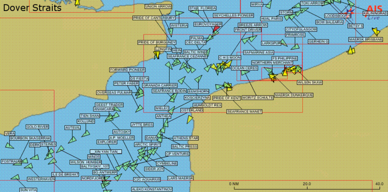
Vessels over three hundred tonnes passing through Dover Strait at one point in time. Image credit: Author Pline via Wikipedia
A waterway like the English Channel challenges adventurers to tackle it. We have all heard about those who have swum the channel. The first person to swim the English Channel unaided was Captain Matthew Web in 1875. The first woman to swim the channel was 19 year old American, Gertrude Ederle, in 1926 and the first woman to fly across the channel was Harriet Quimby in 1912. Unfortunately Harriet’s achievement passed with little publicity as the media was busy reporting on the sinking of the Titanic. A BBC Top Gear presenter crossed the channel in an amphibious car in 2007 and the first ferry crossing was in 1821.
Once the Pont-Aven was clear of the English Channel it turned south and entered the Bay of Biscay. The weather forecast for the bay was encouraging: twenty knot (35 kph) winds and a swell to four metres. For a ship of such mass a swell of four metres was not a challenge.
It is generally accepted that the Bay of Biscay covers an area of approximately 223 000 square kilometres with an estimated average depth of 1744 metres and a maximum depth of 4735 metres. I have not been able to find exactly where the deepest point is so if any readers know please let me know via comments. One thing I do know about the depth of the Bay of Biscay is if a small stone dropped into the sea over the deepest point it would take thirty minutes to touch bottom.

Map showing depth contours 200, 1000 and 4000 metres and current origins and directions.
The Bay of Biscay is said to be the roughest body of water in the world. It is often referred to as the Cape of Good Hope of Europe. Mariners have feared the Bay of Biscay for centuries and not without cause. There are over fifty shipwrecks around its shoreline and it is not uncommon for vessels even today to come to grief.
The reason for it being wild is complex. It is caused by general oceanic and local currents combined with the fact it sits on the edge of the Atlantic Ocean and the European continental shelf. Storms travelling across the Atlantic have a fetch of thousands of kilometres that allow storms to develop to their maximum intensity. Winds up to 130 kilometres per hour and waves to ten metres in height have been reported.

The westerlies that sometimes pound the Bay of Biscay emanate thousands of kilometres away
off the coast of America and Canada..
There have been many reports of huge waves in the world’s oceans, some as high as nineteen metres. Some people believed that giant waves or rogue waves were a matter of myth, however in 1995 the sceptics were proven wrong as a nineteen metre high wave was recorded on scientific instruments attached to a North Sea oilrig.

A cruise liner battling big seas in the Bay of Biscay. Image credit: gcaptain.com
Another factor relating to the bay’s feared conditions is the fact that the European continental shelf runs out into the bay creating shallow waters inshore. The shallow waters are a factor in big wave formation and when they finally reach the shore they create fine sandy beaches, a Utopia for northern European holiday makers and surfers alike. Unfortunately currents and waves concentrate flotsam and jetsam. It is reported that in the Bay of Biscay there are twenty pieces of plastic per square kilometre floating around in the bay which will eventually wash ashore if they don’t end up in the gullet of marine creatures.

One of the fine sandy beaches around the Bay of Biscay. Image credit: from a poster in Santander.
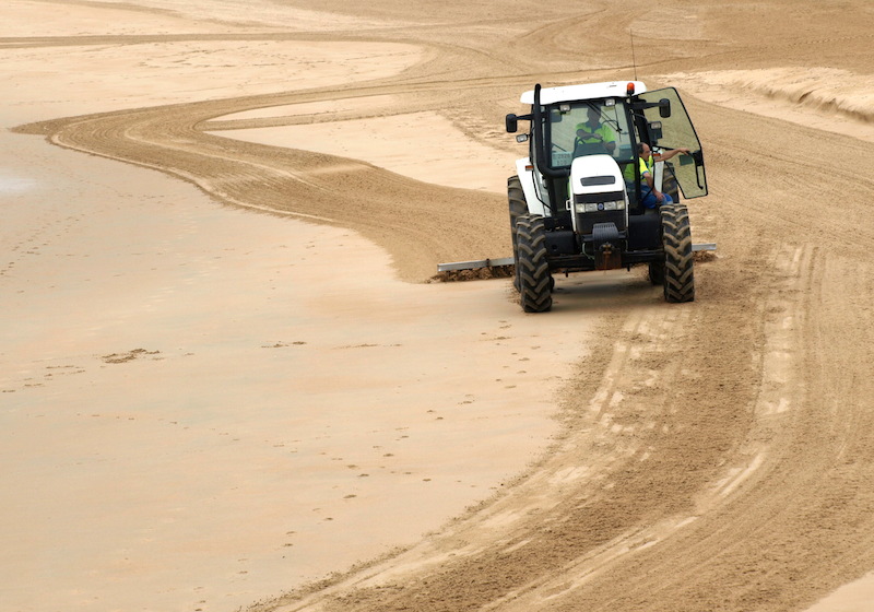
Any rubbish washed ashore along the beaches of Santander is soon gathered up by the beach sweepers.
That’s’ the end of this post. The next post will relate to the city of Santander and surrounds. Bev and I hope you tag along. At this stage we have a vague idea where we are going but how we are travelling we are not sure. Our options include train, bus and of course our foldup bikes. The map below shows the rail network in Spain and Portugal and as can be seen we have many options available to us if we decide to travel by train.


Lovee this
Hi Glen
I am interested in what you found so interesting in the Portsmith to Santander post. Have you done the trip or were you interested in the Bay of Biscay.
Fred and Bev
Amazing the amount of wood in those old ships! Love the photo of your boats Fred. Great journey so far looking forward to the next post.
What an interesting journey to Spain! It certainly fits in with your adventurous spirit. Keep the stories coming.