OUR JOURNEY TO TASMANIA — LAND of the ANTIPODEANS
WEST COAST WILDERNESS
The Arthur River and the Tarkine

A calm Bass Strait
After arriving in Devonport on the north coast of Tasmania we drove east and stayed a few days with friends. It is always a good idea when venturing into the wilderness to have a contact and advise them of one’s movements from time to time so if something untoward happened they can alert authorities. Max, our friend and contact, not only looks after our interests generally but he also gives us up-to-date weather forecasts from an experienced Tasmanian’s point of view.

A rural scene in the north.
If you are in a place where you do not have access to weather forecasts, such as when kayaking or walking in a remote location, being able to read the clouds is very beneficial. Carrying a set of cloud cards is handy and even though I didn’t have them on this journey, if I remember rightly the clouds in the above photograph indicated rain within 24 hours.

Cloud types. Image credit Valentin de Bruyn via Wikipedia.
Clouds can be broken into three categories: high, middle or low. Clouds with vertical growth such as Cumulonimbus (Cb) usually mean rain within ten hours.

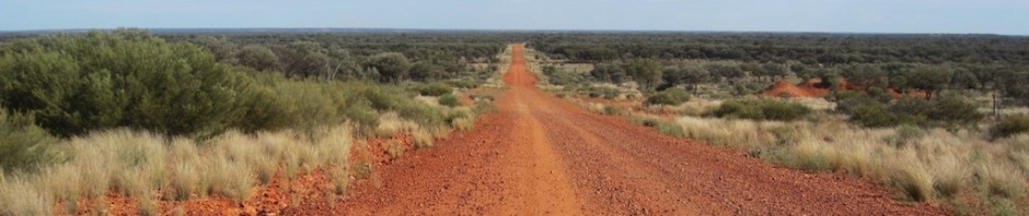
Rolling hills of northern Tasmania. This photograph has not been enhanced; the colours are exactly as they appear.

The wonderful colours of soil and crops.
The red and brown colours in soils indicate high iron content. Soils with a high percentage of iron are called ferrosols and in Tasmania such soils support the majority of the state’s potato, vegetable, poppy, cereal, beef and sheep production. Ferrosol is the name used by the geological fraternity where the name krasnozem is used in agricultural circles. Krasnozem is a Russian word meaning red soil or land.
From the rolling hills of the north, we headed west to the Tarkine wilderness region that we had last visited thirty years ago. At that time we were doing a Tasmanian tour of wilderness areas with our two sons aged ten and eight.

Map of the Tarkine. The Tarkine is difficult to define but it is basically the patchy green area.
The Tarkine region and the Savage River National Park contain the largest area of Gondwanan cool-temperate rainforests in Australia. All rainforests in Tasmania are classified as cool temperate which are the most floristically complex of all rainforests. Other rainforests are tropical, subtropical, monsoon and temperate.

Tasmanian cool temperate rainforest.

Resident of the rainforest, bracket fungi.
Bracket fungi are of the polypore genus Phellinus. They are hard and appear inert and it’s hard to imagine they would have any uses but they did, Aborigines used them for medicinal purposes. The smoke from burning fruit bodies was inhaled to cure sore throats and scrapings from charred fruit bodies when mixed with water were drunk to treat coughs, fevers and diarrhoea. Unfortunately there is some uncertainty as to which species was used so the reader should not go on a bracket fungi binge to cure any of the listed ailments.
Another claim to fame associated with the Tarkine is its complex geology. These areas mean mineral wealth and mineral wealth means mines and according to some conservationists, the inevitable destruction of the flora and fauna of the area. In the case of the Tarkine, mines could also mean the possible destruction of Aboriginal sites dating back thousands of years. The Australian Heritage Council described the Tarkine as one of the world’s great archaeological regions.
Aboriginal people who lived in the Tarkine region have long since gone. With the original inhabitants gone or subdued, European farmers, timber getters and prospectors arrived. The exploiters, as some people call them, came to the Tarkine in the 1870s. Two of Tasmania’s largest gold nuggets of 7.6 and 4.4 kilograms were found near the confluence of the Whyte and Rocky Rivers. Tin was also mined as was tungsten, silver and a not so common ore, osmiridium. Osmiridium contains iridium, osmium and to a lesser degree traces of the platinum group of metals. The main use of natural occurring osmiridium was in the manufacture of fountain pen nibs, scalpels and other items requiring long wearing points. It was also used in the manufacture of osmic acid, used in fingerprint microscopy and recording. Some years ago I spoke with a modern day osmiridium prospector who didn’t go scratching with pick and shovel but swam along the bed of rivers equipped with scuba gear looking for pieces caught in rock crevices.
Two modern industrial mines are currently operating in the Tarkine area, a small silica quarry and a large open cut iron ore mine near the town of Waratah. Both these mines are just outside the Tarkine wilderness boundary, however there are plans to extend the iron ore mine, which will encroach into the Tarkine. At the moment there are 38 exploration licences active and ten mines proposed.

Open cut mine. Image credit: Save the Tarkine web page.
The issue of mining in the Tarkine is highly contentious and even though it is predicted the proposed mines will take only 1% of the Tarkine the impact according to conservationists will be immeasurable. One conservation group, the Tarkine National Coalition and Operation Groundswell are warning if the mines go ahead there will be a campaign that will surpass the Franklin River campaign of the 1980s. A local told me he doubted if the mines would proceed because wages in Australia are far too high for the mines to be profitable. This remains to be seen.
The following photograph shows what the conservationists are worried about.

Acid mine drainage into the Whyte River at Luina has created a six kilometre dead zone. The Whyte flows into the Pieman River, which is located in the Tarkine wilderness. Image credit: From Save the Tarkine web page.

Saving World Heritage areas is a very serious business for many Australians. Image credit: Wilderness Society.
Another threat to the environment in Tasmania is the clear felling of remnant native forests for woodchipping. Although cleared native forests are replanted with native eucalypts the areas become mono specific and therefore support little biodiversity. Plantation forests are planted with a NSW species, Eucalyptus nitens (Shining gum). In the north of Tasmania many plantation trees have died and I was told it was because wrong species were planted in non compatible soils and at the wrong time of the year. From what I understand, the establishment of plantations had tax benefits for the landowners regardless of whether they came to fruition or not.
In 1990 Bev and I had the opportunity to go into a clear-felled area and all I can say is man has such a small mind when it comes to preserving the natural environment for future generations.

An ancient giant eucalypt stump and a group we joined to visit a clear-fell area. Do we have the right to kill such giant creations?
Fortunately the world’s tallest flowering plant/hardwood tree has been spared. It is a 101 metres tall Swamp gum (Eucalyptus regnans) and is called the ‘Centurion’.
Clear felling and replanting to plantation forests is a complex business. After useable timber has been removed all flora that might hinder the growth of plantation trees are burnt using napalm dropped from helicopters and animals that might take a fancy to young plantation seedlings are shot. Up until recently 1080 poison laced carrots were distributed to eradicate the area of wildlife.
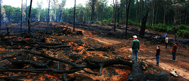
After a burn. The orange colour here is a volunteer plant: species unknown. Image credit: From The Bushwalking Blog and thanks to Sarah Day.
Conservationists are saying: ‘Those responsible for destruction of the forests and for mining development have never learned to appreciate what wilderness has to offer humanity. The only way to appreciate it is to camp in its depths, live and breathe it and then and only then it is possible to understand why the fight must go on to protect the pristine wilderness areas.’
Bordering the Tarkine wilderness to the north is the historic property of the Van Diemen’s Land Company at Woolnorth. It’s the oldest and largest dairy farm in Australia and has been purchased by a Chinese billionaire operating under the name of Moon Lake Investments. It produces around 100 million litres of milk, processed by Fonterra, which is sold into the Chinese market and no doubt it will use the fact that the cows producing the milk graze on a property with the cleanest air in the world.
For decades various government instrumentalities have been gathering air samples at Cape Grim in the Woolnorth region. The samples are used as a basis from which to gauge air quality around the world. The collected samples are stored in a secret location in special stainless steel containers.

One of the cylinders used to store air in the archive. Cylinders under normal atmospheric pressure hold about 34 litres of air but under compression about 2000 litres. Image credit: ABC Northern Tasmania-Fred Hooper
The map below shows the northwest region of Tasmania and the location of Woolnorth and the Arthur River.
 Cape Grim, shown on the above map, acquired its name from a grim event in 1828. A group of Tasmanian Aboriginals comprising about thirty individuals were rounded up and shot by four Van Diemen’s Land workers near what is now called Cape Grim. The bodies of those slaughtered were thrown over the sixty metre high cliff into the sea below. The massacre was part of the ‘Black War’ that raged across Tasmania from the mid 1820s to 1832. The actual Cape is on private land and therefore it is not possible to visit, the only way is to take a private tour.

Looking north towards Cape Grim from Greens Beach near Marrawah.
Marrawah, north of Arthur River is Tasmania’s westernmost settlement and the furthest settlement from Hobart.
The reference on the above map to Hellyer Country: Henry Hellyer was a surveyor architect who explored most of northwest Tasmania for his employer, the Van Diemen’s Land Company (VDL Co). The company had the view that the royal charter granted to them by King George lV made them the legal owners of the land and Aboriginal people of the northwest were therefore trespassers.
Our first wilderness experience on this journey was to the Arthur River Conservation Area in the northwest. The Arthur River rises in the Tarkine wilderness and discharges into the Indian Ocean at a spot called the Edge of the World, a phrase coined by a local who wrote a poem about the coastline at Arthur River.

An aggravated Edge of the World.

Looking out to the Indian Ocean at the Edge of the World.
The mouth of the Arthur River stands at a latitude of 41.03 degrees of south and if you were to sail around that latitude, albeit against prevailing winds, in a westerly direction you would pass under Africa and run aground on the east coast of Argentina. The Roaring Forties are strong westerly winds found in southern latitudes of between 40 and 50 degrees south. The Roaring Forties sit above the Furious Fifties.

A beautiful map showing the Roaring Forties clipper route from Europe to Australia. Image credit: No machine-readable source provided but according to Wikipedia, Johantheghost is possibly the author.

Bev wandering along a driftwood strewn beach at the Edge of the World.
In times of floods logs are washed down the rivers and out to sea then they are washed up onto the beaches when strong onshore winds prevail. Most of the beaches on the west coast of Tasmania are strewn with driftwood and bull kelp, both harvested for commercial gain. Furniture makers come for the wood and kelp collectors shred the kelp which is used as the basis of many organic fertilizers.
Fortunately we were able to look in on one of two kelp processors in Tasmania, Marrawah Pty Ltd. The second is on King Island in Bass Strait. Only kelp washed ashore is used and once gathered it is hung out to dry. When atmospheric dry it goes into a drying room.

Bull kelp hanging to dry.
Once kelp is dry it is put through a hammer mill and broken down into granules. The granules are shipped off to various processors where it is sold as fertiliser, powder for human consumption and for stock feed. According to the professor of aquaculture at James Cook University, kelp added to stock feed can reduce cattle methane flatulence and burping by up to 99%. There are approximately 1.3 to 1.5 billion cows on planet Earth at the moment and their burping, and to a lesser degree their flatulence, contributes significantly to global warming.

Dry kelp washed ashore on a stony beach. Dry kelp is not normally harvested as it is difficult to handle

Kelp growing on rocks.

Getting a piece of bull kelp with the idea of making a stock of kelp energy bars.
Kelp is good for the health as it is an excellent source of up to fifty minerals and micronutrients, especially iodine and potassium. Sushi is not the only way to enjoy seaweed, there are a number of delicious recipes on the web and one that particularly interests me is a kelp energy bar. Kelp is good for circulatory, lymphatic, urinary and nervous systems. It is claimed eating kelp helps loosen stiff joints and helps in maintaining a health digestive system.
Because of its toughness kelp would be good gasket material and maybe it would make good tap washers too. And below is an image where it has been used as a craft material.

Kelp candle holder.
Jacko and his sons, of the Marrawah kelp company, drive along the beaches with trailer in tow and collect the kelp washed ashore. A west wind suits them best as detached kelp is blown ashore whereas an east wind blows the kelp out to sea.
The kelp gatherers are not the only people who drive the west coast beaches. Four-wheel drive enthusiasts come for the excitement of beach driving, but care has to be exercised as there are occasional pockets of quicksand waiting to trap the unsuspecting driver. Quicksand is usually where fresh water creeks run into the sea.

Holiday ruined? Image credit: Copied from a photograph on the wall of NP Office Arthur River.

Overwhelmed by the incoming tide. Image credit: Photo by T & A Atkins. On wall at N.P. Arthur River Office.
On one of our exploratory walks along the beach the sun was out and the temperature agreeable but on the return trip we were fully decked out in winter gear including waterproof pants, thermals and rain jackets. The temperature I guessed dropped fifteen degrees in a matter of minutes and add to this the chill factor and we had a two-degree walk back to camp.

Bev wrapped up against the biting wind.
There is one aspect of Tasmanian weather that needs to be considered and that is its changeability and it’s foolhardy to think a sunny morning will continue throughout the whole day. There is a saying in these parts: If you don’t like the weather, come back in five minutes. The reason for the temperatures changes is because Tasmania is located between 40 and 44 degrees south latitude and therefore it has a warm maritime climate. No part of the Tasmanian landmass is further than 120 kilometres from the sea. This short distance from the sea is what makes for snap changeable weather.
The most distant point in the world from the sea in any direction is in west China. In 2001 Bev and I were fortunate to visit the town of Turpan in west China, which is very near the theoretical Centre of the Earth. The weather there is stable because it is well away from maritime influence but it does suffer from extremes, minus fifty degrees in winter and plus fifty-five degrees in summer. Turpan is located in a depression 154 metres below sea level. The surrounding landscape is spectacular. Rising out of the depression are the Mountains of the Moon, 4000 metres high.

Yurts high up in the Mountains of the Moon near Turpan. The original photograph was a 6 x 4.5 colour transparency.
Getting to the actual centre of the Earth is not so easy as two cousins, Richard and Nicholas Crane, found out in 1986. They undertook a cycling journey to the centre of the Earth. The point is located within a military zone and the Chinese military do not tolerate trespassing into no go zones.
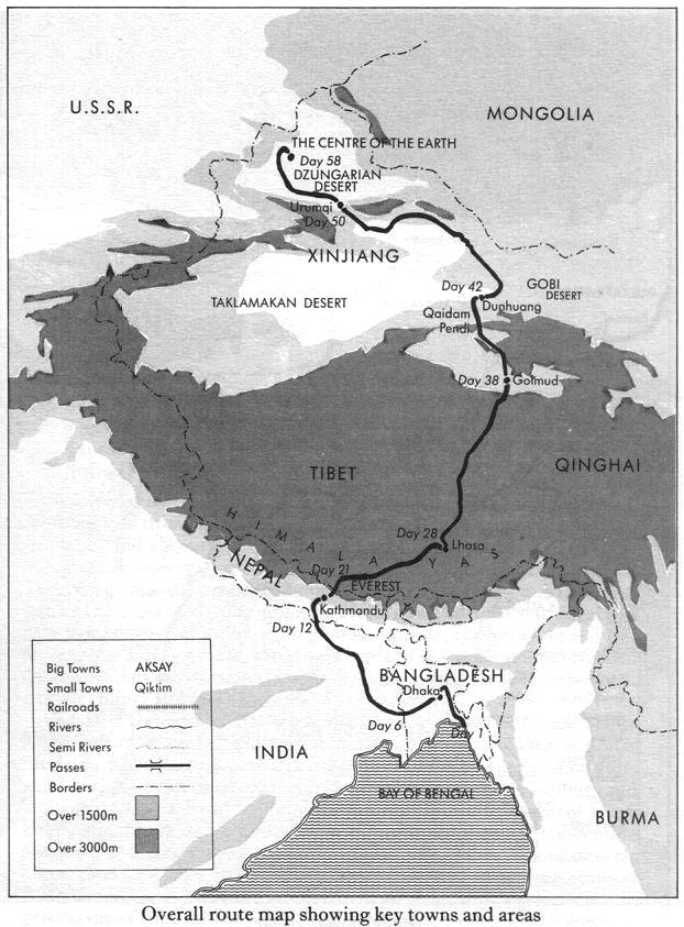
From Bangladesh, up and over the Himalaya Mountains to the Centre of the Earth.
The boys related their experiences in a book ‘Journey to the Centre of the Earth’. It’s a great read and after travelling the country through which they rode I have nothing but admiration for them.

Typical of the country in west China through which the two cyclists rode to get to the Centre of the Earth.

On the way back to camp and assessing how many tables could be made from a driftwood log
Prior to setting off on a walk in the wilderness, even if it is only for a day, the changeable weather is a major consideration. On longer walks when the weather turns bad one can be held up for days. On one occasion when walking in the Western Arthurs SW Tasmania Bev and I spent 36 hours, the majority of them in our tent, waiting for the weather to clear before continuing on the walk. Rain is not an excuse to stay put but strong winds are, strong winds could easily blow one over a cliff.

Lake Promontory, Eastern Arthurs.
While walking along the beach and kelp collecting there were a myriad of things washed ashore but one particular object that took our fancy was the egg case from a draughtboard shark.

Egg case of a draughtboard shark.
The sighting of the draughtboard shark egg case was not our first. Over the years I have drawn all manner of creatures in my notebooks. By drawing an object I am more likely to remember its markings and distinguishing features. Following is a sketch from one of my Tasmanian notebooks.

Page from Tassie notebook circa 2001.
My sketch of the draughtboard shark does not do the subject justice so I have plucked a much more detailed drawing from the web.

An 1892 illustration by Arthur Bartholomew of a draughtboard shark (Cephaloscyllium laticeps). Image credit: From Wikipedia.
Some creatures are too dangerous to get close to and draw, for example, a snake, which we met on one of our walks through the sand dunes.

A tiger snake taking a bath at the Edge of the World. I didn’t stay long enough to draw this one. The snake above was about one and a half metres long.
Snakes are very good swimmers and can actually move faster in water than on land. Their attraction to water is to feed on frogs, eels and fish and they can stay submerged for considerable periods.
There are only three species of snakes in Tasmania which are the White-lipped, Lowland Copperhead and Tiger. The latter two are highly venomous, whereas no human deaths have been attributed to the White-lipped. During past walks in the wilderness we have only ever seen tiger snakes and, interestingly, not at all like the one in the above photograph. The ones we have encountered were black without stripes, much like the mainland blue-bellied black snake.
In 2005 we took two Swiss friends on a ten day walk into the Walls of Jerusalem and at the time it was dry and snakes were concentrated around small tarns where of course we wanted to camp. In the evening a couple of tiger snakes passed through our camp and Josef followed them, as he was anxious to know where the snakes were going to sleep the night. One disappeared into a hollow log near where his tent was pitched so he moved his tent.

Bev with Swiss friends Thomas (left) and Josef at the end of our ten day walk into the Walls of Jerusalem.
The structure behind is a registration booth. Walkers going into the wilderness are encouraged to register their intentions so in the event of an emergency authorities can track them down.

Walls of Jerusalem. The tiger snake camp was down by the lake.
The Tarkine is not as mountainous as the Walls of Jerusalem but as a destination it is well worth a visit. Following are some photographs around Arthur River on the edge of the Tarkine.

The bridge across the Arthur River and part of the Arthur River settlement on the horizon.

Crossing the Arthur River by punt in the 1950s.

Walking over the sandhills to a beach north of the Arthur River mouth.

Bev taking shelter in the driftwood logs.

Volunteer plants (species unknown) regenerating a fire ravaged site.

A crayfish boat hauled up for repairs prior to the commencement of the season. The season commences in November and closes in September.
The blue sky is an unusual event on the west coast of Tasmania. A local farmer told me that last winter there were only fourteen cloudless days.

No Bondi Beach but it is free of human flotsam and jetsam.

Inactive geology.

Unusual geology. I am attempting to obtain an explanation for this formation.

Pied oystercatcher on the prowl.

Our $3 per person camp in the Arthur River Conservation Area.
For readers of this blog who might like to venture to the Arthur River region you might like to know bush camping at the Arthur River is easy. There are many bush camping sites within the conservation park. Water is on tap and toilets are within each camping area. There is no firewood available (plenty of driftwood on the beaches though) so you have to bring your own. Camping fees are $3 per person per night.
On that note this post comes to an end. Should you wish to be alerted each time we do a post click on FOLLOW and make a comment if you wish.

That’s a Pied Oystercatcher, the Sooty is all black.
Hi Suzanne
Thankyou for your comment…of course you are right it (the photograph) is a Pied oystercatcher not a Sooty. I call the oystercatchers the ‘old man bird’ and my nickname relates the the way they walk. The post has been edited and thanks again for your keen eye.
Regards Fred and Bev